The Intertidal – A Race Against Tide and Time
The Intertidal Race, which takes place on 15 August 2026, is not just a physical challenge, it is a journey across a seascape that teems with life, history and cultural heritage.
The Intertidal Race, which takes place on 15 August 2026, is not just a physical challenge, it is a journey across a seascape that teems with life, history and cultural heritage. The route passes through an internationally important natural wilderness with a legacy that begins 600 million years ago and continues through to the fortifications, piers, quarries and vraicing trackways that symbolise the Island’s militaristic, economic and social history. There is nowhere else on our planet quite like it and The Intertidal race offers a unique opportunity
Taking that first step from land to sand will place you inside Jersey’s South-east Coast Ramsar Site which is a designated wetland of international significance. The wide, sandy expanse of Grouville Bay is home to one of the largest areas of intertidal seagrass in Europe and many seabirds which come to feed on worms, clams, crabs and shrimps. Past the seagrass, at the southern end of Grouville Bay, is an aquaculture zone with oyster trestles and mussel poles whose produce is farmed for export to Europe and Asia. Our seashores may be special and protected but they can still fulfil an economic role especially for sustainable businesses.
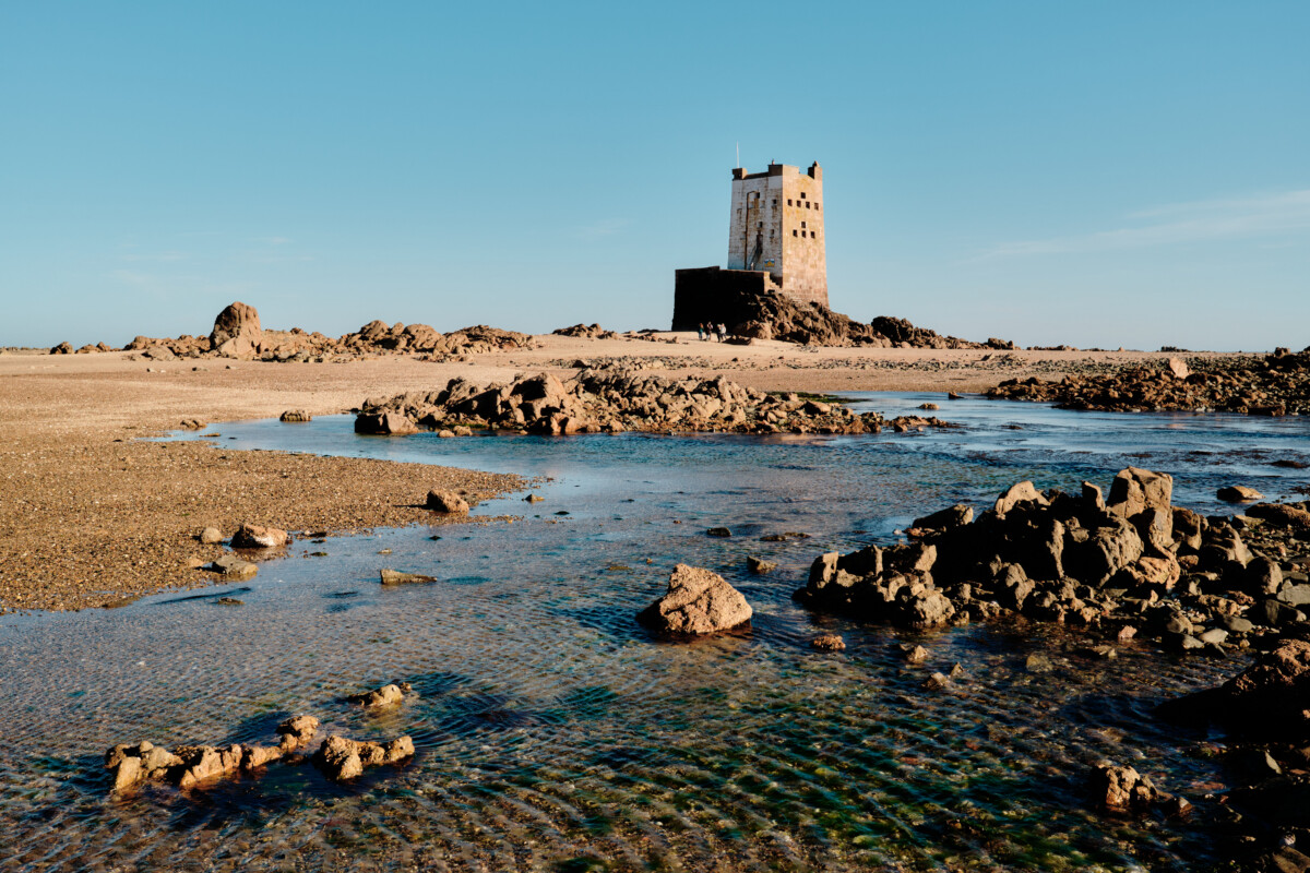
The southern edge of the bay transitions from flat sand to an elongate area of raised rock and gravel. This is the Violet Bank whose eastern end is marked by Seymour Tower, an iconic Jersey landmark that has been guarding the Island since the failed French invasion of 1781. The going underfoot might be rough but take comfort in knowing that around you is a terrain that has been used by humans for over a quarter of a million years and which, according to a recent archaeological survey, may once had been home to stone age community that was drowned by the rising sea.
Nearer to shore, the picturesque harbour of La Rocque reminds us of a time when each high tide would herald the departure of the Jersey oyster fleet whose catches, for a time, made the Island wealthy. The oyster dividend paid for La Rocque Pier and many of the seawalls that fringe the running route. The path between La Rocque and Icho Tower will take you along a network of abandoned tracks that were built for collecting seaweed which was once a valuable commodity. The tracks wiggles through rocks, gullies and across sandflats taking you to the distinctive pebble beach below Icho Tower.
The round tower at Icho is another legacy of nineteenth century tension with France but in medieval times the islet held a mystical significance and would, once a year, be visited by a ‘solemn procession’ Le Hocq residents. This is your furthest point from shore and once the tide has turned it does not pay to linger. Head directly towards the round tower at Le Hocq, past more oyster tables and along a wide gully of inconveniently soft sand.
The route along the south coast hugs the upper shore and passes by places with evocative names such as Le Havre ès Môques (bay of mosquitoes), La Roche Larron (the villain’s rock) and La Sordonnière (the place of sea slugs). A checkpoint at Green Island (aka La Motte) brings you into an area internationally recognised (and locally protected) for its geology which preserves an ancient battle between two magma chambers deep below the Earth’s surface.
Beyond Green Island is the open expanse of Grève d’Azette. The route is framed by a dramatic line of rocks on the seaward side and an urban backdrop which heralds the approach of St Helier. Pass by Le Dicq, once the haunt of exiled French poets, and cast an envious eye at swimmers enjoying the cool waters at Havre des Pas Lido. The route leaves the beach at La Collette where a lack of seashore requires skirting the edge of town. A return to the intertidal at West Park starts with a visit to Elizabeth Castle which has been protecting the harbour for 400 hundred years and, a thousand years before that, was home to St Helier himself.
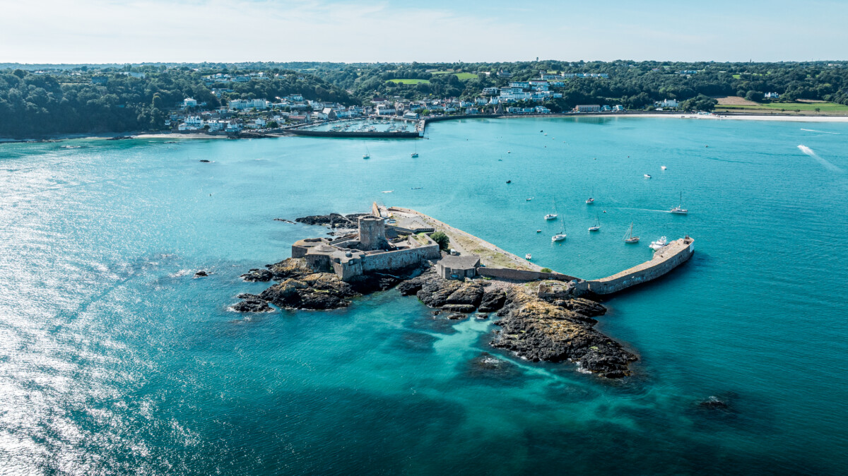
The final stretch sees a return to an open sandflat and seagrass environment which mirrors the opening few kilometres at Grouville. This is St Aubin’s Bay and your target is the compact outline of St Aubin’s Fort which was built to protect its eponymous harbour. The Fort is the final checkpoint from which it is just a few hundred metres to the shore across a rather damp and, unusually for Jersey, muddy patch of beach. Climb the slipway to find the finish line and a much needed rest. Congratulations for completing The Intertidal race and for having visited what is a unique and much loved part of Jersey’s natural heritage.
Are you ready to beat the tide?
Sign up to take part in a race like no other.